
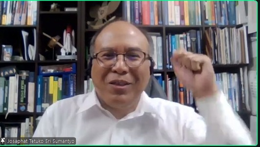
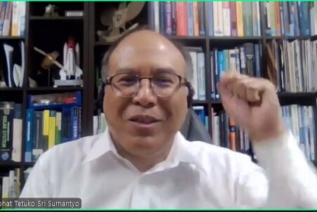
Yogyakarta – Thick clouds, which have long obscured optical satellite imagery in tropical skies, are not the end of the story. At a guest lecture on Natural Resources and Environmental Management (PSDAL), organized by the Environmental Science Master Program at the Graduate School of Universitas Gadjah Mada (SPs UGM) on Thursday, October 1st 2026, Prof. Josaphat Tetuko Sri Sumantyo from Chiba University, Japan, introduced radar as a solution.
More than 100 participants from various institutions attended Josaphat’s presentation on remote sensing based on synthetic aperture radar (SAR), delivered online via Zoom. Prof. Josaphat demonstrated how this technology can be used to identify signs of disasters and environmental changes, even before damage occurs.
Prof. Josaphat began by distinguishing two types of sensors. Optical sensors, he explained, rely on sunlight. Without light or when obstructed by clouds, the resulting images will be unclear. SAR works in the opposite way: this active sensor transmits microwaves from satellites, aircraft, or drones, then records the reflected signals to produce images. As a result, SAR can capture the Earth’s surface at night or in cloudy conditions, a crucial capability for Indonesia, where the sky is often covered by clouds. The polarization analysis of SAR is able to reveal the physical properties of objects, such as the inclination of tree trunks.
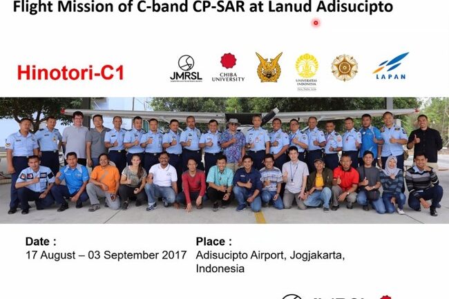
The professor then introduced circularly polarized SAR (CP-SAR), a technology developed by his team at Chiba University, complete with a custom-designed antenna. The device was tested in flight at Adisutjipto Air Force Base in Yogyakarta in August–September 2017. The results showed that CP-SAR imagery remained sharp even when optical cameras could not penetrate the clouds.
Prof. Josaphat then presented several practical applications of SAR:
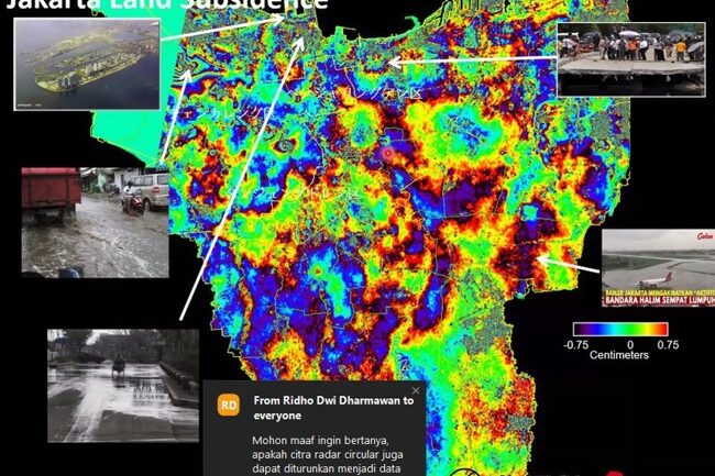
- Land subsidence and coastal sedimentation in Jakarta have been monitored using SAR data.
- Land uplift caused by the Noto earthquake in Japan on January 1st 2024, was successfully detected.
- Landslides in Cameron Highlands, Malaysia, were mapped.
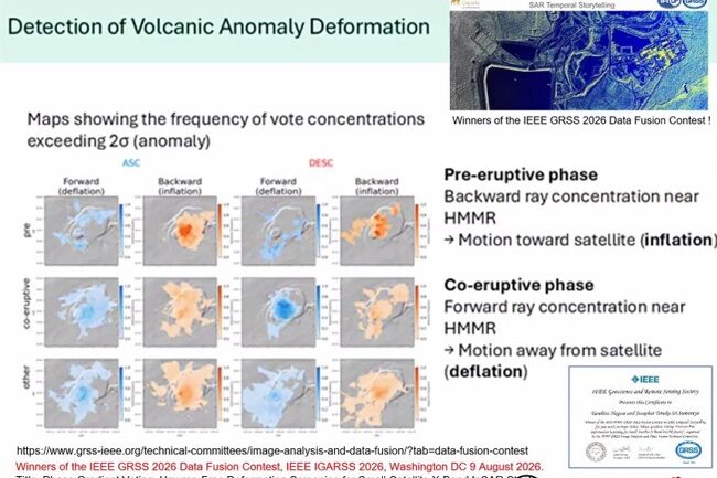
- Volcanic deformation anomalies were identified. This research helped his team win the IEEE GRSS 2026 Data Fusion Contest in Washington, D.C., on August 9, 2026.
According to Josaphat, data of this kind can be used to anticipate disasters such as forest and land fires, enabling preventive measures to be taken before the flames spread.
The discussion was lively. Participants asked about SAR’s ability to detect oil spills, the need for terrain correction using a digital elevation model (DEM) when analyzing burned areas in mountainous regions, developments in InSAR and the NISAR satellite, the use of artificial intelligence in radar imagery, and how to select the appropriate frequency band. Regarding the last question, Josaphat advised researchers to first define the object of their study before selecting the imagery and its corresponding band.
He encouraged students to write books, emphasizing that written works would continue to live on, while awards should be regarded merely as a bonus at the end of the session. He also urged Indonesian researchers to strengthen collaboration and respect one another. “We should not adopt the mindset of trying to catch up, because we are not actually left behind. A nation’s greatness cannot be inherited; we must build it starting now,” he said.
This guest lecture made students in the Environmental Science Master’s Program in at SPs UGM gain insights into how remote sensing can be used to manage natural resources and mitigate the impacts of disasters. The event also served as a follow-up initiative to the collaboration of the Graduate School of Universitas Gadjah Mada and Chiba University.
Author: Siti Muyasaroh