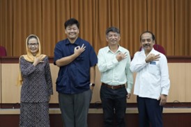


Yogyakarta, August 4th 2025 – The Geo-Information for Disaster Management Master Program, Graduate School of Universitas Gadjah Mada (UGM), in collaboration with National Taiwan University (NTU), held a public lecture at the SPs UGM Auditorium. The lecture’s theme was “Exploring Dynamic Landscape with Digital Terrains and High-Quality Field Observation.”
One of the motivations behind this public lecture was the utilization of geospatial information, which plays a vital role in supporting spatial planning and disaster management. Based on this, the Geo-Information for Disaster Management Master Program and Spatial Planning collaborated with the Department of Geography, National Taiwan University (NTU), to organize this lecture.
The purpose of this public lecture was to provide a space for scientific discussion among students, lecturers, and international experts to broaden insights and deepen understanding of strategic issues in spatial planning and disaster management. Furthermore, it aimed to encourage the development of networks and potential international research collaborations between Universitas Gadjah Mada and National Taiwan University in the fields of geoinformation and applied geography.
The speaker for the public lecture was Prof. Huang Jr-Chuan from NTU, who discussed topics such as the water cycle, watershed areas, tropical cyclones and disaster mitigation, geological conditions and structural mitigation in Taiwan, as well as the similarities between Taiwan and Indonesia’s landscapes.
The second speaker, Dr. Yang Ci-Jian, also delivered important material on the use of geospatial technology, specifically geophone technology. Dr. Yang also shared insights on Badland studies in Taiwan by comparing previous and recent research findings.
This public lecture was attended by a diverse audience, including students, alumni, faculty members, and practitioners. All participants actively engaged with the speakers through discussion and Q&A sessions. It is hoped that this event will broaden participants’ knowledge and understanding of geospatial technologies and their development, particularly in disaster management.
Author: Siti Muyasaroh