


Yogyakarta (12/6) Ensuring the theories taught in the classroom are easily understood by students, field trips are necessary. This was done by eleven Master of Disaster Management (MMB) students from the Graduate School (SPs) of UGM, led by Dr. Nugroho Christanto, S.Si., M.Si, who teaches Disaster Source Monitoring and Early Warning in the MMB program.
The team visited 4 locations: the Lahar Flood Early Warning System (EWS) in Kali Boyong, the Sabo Dam in Kali Gendol, the Alparis in Kali Penang Bendung Silumbu, and the BPBD Sleman Operations Center in Yogyakarta on May 29th, 2024.
The Lahar Floods of Kali Boyong, the Sabo Dam of Kali Gendol, and the Alparis Kali Penang Bendung Silumbu are three locations in Sleman, each with different functions and threats during eruptions of Mount Merapi or heavy rainfall, requiring appropriate disaster mitigation measures.
For example, in the Kali Boyong Flood, which is one of the tributaries of the Progo River, the main threat is the flow of volcanic material from Mount Merapi, so the Sleman District BPBD has installed an Early Warning System (EWS) and Close Circuit Television (CCTV) at the Kali Boyong Flood and the Pulo Watu Bridge.
This system is connected to the command center to provide early warnings to the community. Similarly, the Sabo Dam of Kali Gendol, located in Argomulyo, Cangkringan, also faces the threat of lahar flow from the eruption of Mount Merapi passing through Kali Gendol.
Due to this highly active activity, the government built the Sabo Dam project to reduce the speed of lahar flow, debris, and sediment, which can slow down or hold back the volume of sediment generated by the eruption of Mount Merapi. This project was first built in 1967 and inaugurated in 1973.
In contrast to the previous two locations, Kali Pelang, Bendung Silumbu, located in the Sardonoharjo Village. Ngalik, Sleman, faces the threat of a drastic increase in river water discharge due to heavy rainfall, causing potential flooding in the riverbanks.
With this potential, Dr. Nugroho Christanto, S.Si., M.Si took the initiative to create the Alparis (Automatic River Water Monitoring Tool) to monitor the water discharge in Kali Pelang. The operation of this tool detects using water level pressure sensors and sends the information through an application.
Furthermore, residents around the Silumbu Dam area also created ponds as temporary water retention areas to control the influx of water, and there are aesthetic elements such as ponds and housing.
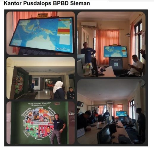
The team also visited the BPBD Sleman Operations Center, located at Jl. Kaliurang No. 17, Pakembinangun, Pakem, Sleman, and was received by Dika, who is responsible for receiving reports and mobilizing or coordinating a force of 59 communities, and confirming reports of disasters in Sleman Regency. Dika also mentioned that there are 3000 volunteers.
This activity is also aligned with the implementation of SDGs Number 4 on Quality Education, Number 13 on Climate Action, and Number 17 on Partnership for the goals.
Hashtags: disaster, disaster mitigation, Mount Merapi, dam, flood.
Author: Arni Wistriatun